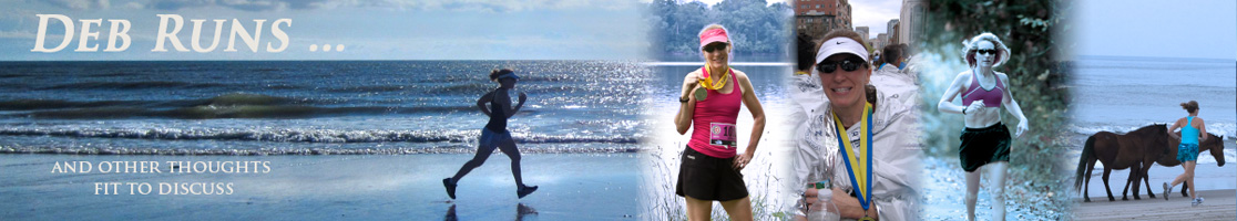
Disclaimer: This 46-Miles of Vermont Gravel, Including a Class 4 Road recap contains affiliate links…
Building the Perfect Course
Our New England vacation focus was on Acadia National Park in Bar Harbor, Maine and as far as I was concerned, a side trip to Vermont would be just that, a side trip. Little did I know that the ride of my lifetime would happen during that two-day excursion.
Vaguely familiar with Vermont Overland, I jumped at the chance to ride 54 miles with 6,600 feet of climbing when my husband Bill suggested it as a possible course. What I didn’t realize was that the course had 7 sections of Vermont pavé which are unmaintained and practically impassable public roads.
Luckily, my husband’s wisdom prevailed and he offered to create a new course using parts of Vermont Overland while adding in some of the area’s beautiful covered bridges which can be found on less technical roads. Bill’s 46-mile course had 4,600 feet of climbing and only one pavé which, until we saw the sign, was one more than we expected. The route was plenty challenging and gave us a little bit of everything from country roads to quaint small town streets, from pavement to normal sized gravel to sand-like cinder, from rolling hills to ridiculous 18% grades. The one consistent throughout the course was the never ending beauty of the autumn season.

Ride Overview
- • Ride With GPS Name: 43-WindsorVTWoodstockCovBr
- • Ride with GPS: Link to turn-by-turn navigation cue sheet
- • Location: West Windsor and Woodstock, Maine
- • Start/Finish: West Windsor, Maine
- • Course Type: Loop
- • Course Surface: Gravel
- • Bike: Cannondale Topstone
- • Distance: 46.11 miles
- • Time: 4:35:59
- • Average Speed: 10.0 MPH
- • Maximum Speed: 31.7 MPH
- • Elevation Gain: 4,603 feet
- • Elevation Range: 682 to 1,684 feet
- • Temperature Range: 62° to high 60’s to 58°
- • Course Map:

Fun Pictures From Along the Way
The following pictures were taken either with my iPhone (affiliate link) or my husband’s Insta360 (affiliate link)…
At 62° and mostly sunny at the start, the weather was perfect…

Bower’s Covered Bridge, the first of four covered bridges…

Fall colored leaves and gravel roads were a constant scene…

Cruising through Best’s Covered Bridge…

Farmland abounded…

Gravel perfection…

Stunning scenery…


Just a little climb…

South Windsor Fire House…

Snowmobile crossing…

South Woodstock Country Store, the perfect place to stop for a snack…

This VeloPig found some velour pigs in the country store…

Cabbage, mums, and pumpkins…

As we rolled out from the country store, little did we know what lay ahead. We knew we were starting a 5-mile climb, but had no idea how intense it would be. The only climb category color guides (based on length and gradient) I’d seen on my Garmin (affiliate link) were green (easiest), yellow (moderate), and red (steepest). I’d never seen burgundy before, but then, I’d never climbed an 18% grade.
During the 18% grade portion of the climb, the road surface changed from packed gravel to fine cinder which, once I caught up with Bill and I caught my breath, I compared to climbing a sand dune.

But wait, there’s more! Shortly after starting the burgundy climb seen on my Garmin above, we came upon this Vermont pavé sign…

Wait, what? Well, my bike isn’t a normal passenger vehicle, but then, I can’t say that I’ve got great mountain biking skills either. Let’s just say there was mostly bike-hiking happening for the next half mile…

The class 4 road ascent which doesn’t look steep in this picture (scroll back up to the Garmin color guide for proof that it was much steeper than it looks)…

And the class 4 road descent… Because there was a thick leaf carpet covering the huge rocks on the road, I mostly coasted down the hill with one leg ready to hit the ground if necessary.

While stopped to take the picture above, I noticed this piece of bark and wondered if woodpeckers had created those holes.

Just as we were coming to the end of the class 4 road, a man who was parked to cut up a tree on the road, asked if we’d seen the mama bear and her cub cross the road. Ummm, no we hadn’t seen it, but later when looking at video Bill had recorded we saw something small and black dart across the road in the distance and then three turkeys run across the road from the opposite direction. We think the mama bear had crossed first, followed by the baby, and the turkeys were running for safely!
After the excitement of riding the class 4 road, we rode through Woodstock, the cutest little New England town. After passing The Green, we came upon Middle Covered Bridge…

We next turned onto a gravel road that parallels the Ottauquechee River. This was my least favorite section of the course because there was a lot of fast moving traffic passing as we rode along precariously close to the river. Eventually, we turned right, crossed Taftsville Covered Bridge, our final covered bridge, and started climbing…

At the summit of our next to last climb we took a break to rest and refuel…


And talk to the cows…

We could feel the temperature starting to drop as the blue sky got covered by gray clouds and hoped we’d finish our ride before rain rolled in…

At the summit of our final big climb…

What goes up must come down, and this was a super fun descent!

Our 43-mile course became a 46-mile ride when we decided to backtrack a little near the end to get some pictures with these gorgeous mountain views in the background…


And before turning to finish our ride, we stopped to admire this barn complete with a cow on the weathervane…

Even though we were finished with our “official” course climbs, we still had to make our way back up the mountain to our Airbnb situated next to a ski run. I was shy of 46 miles when I pulled into our parking lot so of course I looped around and added a half mile to make it a tidy 46-mile ride. Wouldn’t you? 😉
Garmin Stats
Post-ride Garmin picture…

Garmin map and elevation graph…


Final Thoughts on the Ride
This ride truly was one for the books. With 4,600 feet of climbing over 46 miles, an 18% grade on sand-like cinder near the end of a 5-mile climb, and a class 4 road that I mostly had to bike-hike across, we were challenged in the best way possible. Add to that spectacular leaf color during peak week, and the difficult course became incredibly beautiful. Had we only seen the momma bear and her cub that walked right across the road in front of us, this ride would have been pure perfection.
The ride challenged my riding skills and left my heart happy. To say Bill and I had a blast would be the understatement of the year!
Questions:
- • Has fall peaked where you live? ~ We were lucky and got to experience peak leaf season twice this year, two weeks ago in Maine and currently here in Virginia.
- • Our Maine and Vermont rides took us by both lighthouses and covered bridges. Which do you think are the coolest? ~ As much as I love covered bridges, I think the idea behind lighthouses and their various styles is really neat.
- • Do you stop and relax occasionally to fuel or take pictures, or barrel on through when on a long run or ride? ~ Both for me depending on the circumstances…
Disclaimer: This post contains affiliate links which means if you click on the blue product link and then make a purchase, I will receive a small commission for referring you. You will pay no more or less for the product; however, Amazon will show their gratitude for my referral by paying me.
This is beautiful, Debbie! I think you got the most out of this autumn!
Well done on that climb, too. Bike-hiking is hard work!
Imagine if you had racing bikes instead of gravel bikes, that would have been a lot worse.
I love covered bridges, but I think lighthouses are cooler, too!
Thanks, Catrina! And yes, we are stretching autumn out as long as possible. 🙂
What beautiful scenery. I do love covered bridges but I think lighthouse are my favorite because of the water.
You need do a lighthouse ride around Florida.
We are past peak but still pretty. I always stop and take pics during the run. But not a race. Wish my pics were as pretty as yours. I have an old iPhone
I like the Florida lighthouse tour idea. We are planning to ride from Cape Canaveral to Tampa in February.
I think your pictures are beautiful! I would have never guessed you have an older phone.
That scenery (of the mountains) and all those colors! Let’s not forget the climbing, LOL. Looks like a fun adventure on wheels! I need to try to stage one last (???) long ride hurrah before the temps get too chilly (and even more windy). Most likely, my last hilly bike path ride of the 2022 season will be tomorrow…temps are looking decent with no rain in the forecast. That’ll be hilly ride #25!
Yes, we got very lucky with the leaves being so beautiful and the weather so perfect while we were in New England.
You have really hit your hilly bike path hard this riding season!
What beautiful pictures! I’m more of a stationary bike kind of girl so I don’t think I would have lasted very long with those inclines! The covered bridges were absolutely beautiful and I’m glad you and your husband got to take cool pictures and video. The bear sighting would have probably made me pedal a bit faster! I’m in the south so our fall isn’t as pretty as this but it is slowly cooling off!
Where we live, we have to drive about an hour to see covered bridges so we loved seeing them on our ride. I’m not sure what I would have done had I actually seen the bear. I might have fainted! LOL
Oh wow- the ride of your lifetime!!! Everything about this seems amazing. I love when it gets challenging like that- makes it seem like more of an adventure. The scenery is stunningly beautiful. Honestly, if I could ride in places like this I think I might become a cyclist!
I love a good challenge and this ride was that and more! Because we weren’t racing, we had plenty of time to stop and take in the beautiful scenery while we rested.
You all picked the perfect week for your ride. What great scenery in full peak and the weather was great too
Yes, we were very lucky that the weather was so good. 😀
I have absolutely loved following along with all of your biking adventures the past few weeks!
Happy that you had beautiful weather too.
Thanks so much, Kim!
Everything about this is beautiful! Any more adventures coming up or are you both done for now? It would have been cool to see the mama bear and her cub.
Thank you, Zenaida! I agree, if a bear is going to be near me, and not hurt me, I’d love to see it. Our next big bike trip will be in February when we ride across the state from Cape Canaveral to Tampa.