Disclaimer: This Virginia Creeper Trail: 36-Mile Damascus to Whitetop Mountain Climb and Descent recap contains affiliate links…
What Goes up, Surely is Fun Coming Down
Two summers ago Bill rode his bike to the top of Whitetop Mountain on the Virginia Creeper Trail from Damascus while we were visiting my mom; and joining him for the same ride had been on my bucket list since. We left Mom’s house early and by 9:45 we had arrived in Damascus, gotten our bikes ready to roll, and hit the restrooms. At 70° with low humidity and beautiful blue skies dotted with white puffy clouds, we knew it would be a comfortable ride as we climbed under beautiful tree canopies up into the cool mountains.
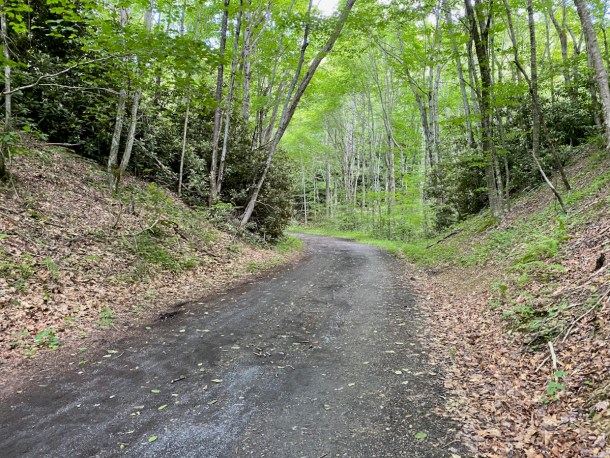
For 18.25 miles we climbed anywhere from about a 1% to an 8% grade on gravel and packed dirt with the occasional slippery mud pit. It wasn’t that bad, just steady slow climbing and I kept reminding myself that the ride flying back down would be worth the monotonous ride up. What I didn’t realize was that as we neared the top of the mountain, van after van of tourists and rental bikes were being transported to the end of the trail where they would begin their slow descent back down the trail. And surprisingly, most would be helmetless.
About Those Rentals
After our ride we stopped by one of the eight bike shops in the town of Damascus where we learned that bike rentals cost $34.99 (plus tax) per person. The rental fee covers use of a bike, helmet, and being shuttled up to the top of Whitetop. Bike available are hybrids, mountain, and cruisers with all have multi-speeds except for the cruisers. Also worth noting, all bikes have standard rim brakes, not disc.
Ride Overview
- • Ride With GPS Name: Damascus to Whitetop on the Virginia Creeper Trail
- • Ride with GPS: Link to turn-by-turn navigation cue sheet
- • Location: Washington and Grayson Counties, Virginia
- • Start/Finish: Damascus, Virginia
- • Course Type: Out and back
- • Course Surface: Packed dirt, gravel
- • Bike: Salsa Journeyman
- • Distance: 36 miles
- • Time: 3:20:19
- • Average Speed: 10.9 MPH
- • Maximum Speed: 21.4 MPH
- • Elevation Gain: 1,677 feet
- • Elevation Range: 1,915 to 3,529 feet
- • Temperature Range: 70° to 81°
- • Course Map:
Fun Pictures From Along the Way
The following pictures were taken with my iPhone (affiliate link) while stopped along the trail. A few were taken by Bill with his GoPro Hero 7 (affiliate link).
Our first stop was to check out the map and refuel only 30 minutes into our ride. It was a good call and my energy level picked up quickly…
And of course if there’s a restroom handy, who am I to pass up an opportunity to make a pit stop?
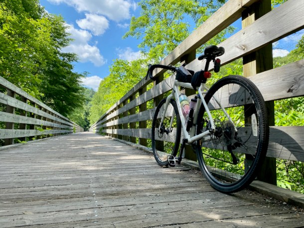
About 45 minutes later we stopped for a quick rest before crossing this beautiful bridge…
And here comes Bill off the other end of the bridge. This would be the spot where on our trip back down he got a flat…
Just beyond the bridge, the Appalachian Trail verged off of its shared section with the Virginia Creeper Trail…
Some signs deserve more attention than others…
Lodging in the Mountains looks to be a little rustic… 😉

Green Cove Station…

Fortunately, Bill remembered this overlook which wasn’t marked and wasn’t easily ridden to (I pushed my bike on the skinny, steep dirt path leading to it)…
A little about the railroad and the railtrail…
Whitetop Station…
We passed Mount Rogers National Recreation Area and rode on a narrow dirt trail that took us to the North Carolina Line and the end of the trail…
Horses welcomed us back into Virginia…
Narrow dirt trail leading back to Mount Rogers National Recreation Area…
One of the many vans dropping off tourists and their rental bikes for their easy descent down the trail… Later in the day while fixing Bill’s flat, the guy at the shop told us that on a good day his store hauls as many as 500 riders to the top of Whitetop Mountain (his store is one of 8 in Damascus who provide this type of bike rental service.
Making our way back down along the beautiful trail at one of the few points where there were no other cyclists around…
Green Cove Station…
We hoped that Green Cove would have sandwiches, but settled on buying a bag of chips and enjoying the bars we had packed…
Stylish decor for tired hikers and cyclists…
Dapper little dude welcoming Green Cove Collective customers…
Shortly after we started back up after lunch, Bill heard a pop and felt air escaping from his rear tire. He had aired-down our tires slightly for a smoother ride and apparently when he hit a rock it caused his tubeless tire to become unsealed. We tried to pump it up with my mini bike pump (affiliate link) but it wouldn’t hold air for very long. I took off for town in search of purchasing sealant (affiliate link) at one of the bike shops, knowing that I might have to ride back up part way to meet Bill if he couldn’t keep air in his tire between stops to pump it up.
Despite my rush off the mountain, I stopped to take a few pictures that I regretted not taking on the way up…
Just as I left the first bike shop empty handed, Bill came flying toward me. He’d managed to get the Gup (affiliate link) he had with him work well enough to hold air in the tire longer as he carefully made his way off the mountain…
And after a more adventurous day than we’d planned, we were back where we’d started…
Garmin Stats
Post-ride Garmin (affiliate link) picture…
Garmin map and graphs…
Final Thoughts on the Ride
Bill and I had a lot of fun on our little adventure; however, it took us away from my mom for much of the day and when we visit I want to spend as much time with her as possible. It’s probably a one and done ride for me, but I’m glad I did it!
Questions:
- • Have you ridden on rail trails? If so, what type of bike did you use? ~ We were on our gravel bikes.
- • Do you know how to change a flat tire? How about putting a plug in a tubeless tire? ~ HaHaHa
- • Do you stop and relax occasionally to fuel or take pictures, or barrel on through when on a long run or ride? ~ Both for me depending on the circumstances…
Disclaimer: This post contains affiliate links which means if you click on the blue product link and then make a purchase, I will receive a small commission for referring you. You will pay no more or less for the product; however, Amazon will show their gratitude for my referral by paying me.


Most of the trails we ride (thus far) are rail trails. They’re nice because the hills are mild, but it feels like we’re constantly pedaling because there aren’t many hills to coast down LOL We rode with our mountain bikes all last year, and for the first part of this season, until we got our hybrids. This ride looks quite scenic…I love the bridges and those old train cars.
I have always loved running and biking on old rail trails because they’re usually not extremely hilly. The reason this one is called the Virginia Creeper Trail is because of how slowly the trains had to maneuver over the mountains.